News Summary
Residents of Greenwood County, SC, should prepare for potent thunderstorms that are expected to roll in soon. The National Weather Service has issued a warning about strong thunderstorms, including pea-sized hail and gusty winds up to 40 mph. Precautionary measures are advised, especially for those in areas like Bradley, Callison, and Troy, as heavy rainfall could lead to localized flooding. Remember to stay indoors and avoid flooded roadways for safety during this storm.
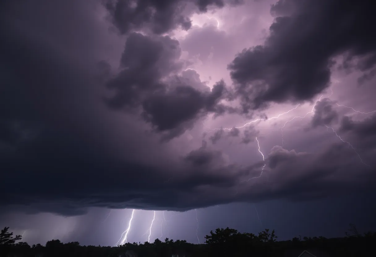
Thunderstorms Set to Hit Greenwood County, SC
Attention, residents of Greenwood County, SC! It’s time to brace yourselves as a potent thunderstorm approaches our area. The National Weather Service (NWS) issued a weather alert at 3:37 p.m. on Thursday, warning of strong thunderstorms that will persist until 4:15 p.m. So, if you’re planning to be outdoors or have anything important to do, take a moment to read this!
What’s Coming Our Way?
As the storm rolls in, expect **pea-sized hail**, measuring around 0.25 inches, alongside gusty winds that could whip up to **40 mph**. Yikes! That means it could get a bit breezy and messy out there. Doppler radar shows a robust thunderstorm currently located about 14 miles south of Abbeville, near Troy, moving northeast at a brisk **30 mph**. So, it’s heading our way faster than you might think!
Potential Hazards to Look Out For
The impending storm poses various risks, particularly for your outdoor belongings. The NWS has issued a friendly reminder that those **gusty winds** could cause tree limbs to come crashing down or send unsecured objects flying. If you have patio furniture or garden decorations, now’s the time to bring them inside to avoid any minor hail damage.
Those living in locations like Bradley, Callison, Troy, Kirksey, and Promised Land should be especially vigilant as these areas are likely to experience considerable storm impacts. If you’re outdoors when the thunderstorm hits, the NWS recommends seeking shelter inside a building. After all, safety comes first!
Stay Dry: Torrential Rain and Local Flooding
But wait, that’s not all! The storm isn’t just bringing hail and wind. It’s also unleashing heavy rainfall that could potentially lead to **localized flooding**. So, keep an eye on those puddles! If you encounter flooded roadways, it’s best not to drive through them. Rushing water can be incredibly deceptive; what seems shallow could very well be deeper than it looks.
Lightning: A Summer’s Concern
Did you know that the United States experiences around **25 million lightning strikes each year**? Most of those occur during the summer months when thunderstorms are common. On average, **20 people are killed** by lightning strikes annually. That’s why when the storm approaches, the chance of lightning increases significantly, peaking when the storm is directly overhead. As the storm moves away, that danger diminishes. Stay mindful and cautious!
Understanding Hydroplaning
As if that isn’t enough to keep you on your toes, the NWS also wants to give you a heads-up about **hydroplaning**. This occurs when water builds up in front of your tires, causing a loss of control on wet roads. The main culprits for hydroplaning include excessive speed, worn tires, and standing water. If you find yourself hydroplaning, experts recommend staying calm and avoiding abrupt steering or braking. Gradually ease off the accelerator and steer in the direction you want your vehicle to go. Keep those steering wheels steady!
Final Thoughts — Stay Safe!
In conclusion, with a storm on the horizon, it’s wise to stay informed and prepared. Keep an eye on the weather and have a safe place to retreat to while the storm passes. Remember, better safe than sorry! With a little precaution, you can navigate through these tempestuous times without a hitch. So, hunker down, grab a cozy blanket, and enjoy some indoor relaxation while Mother Nature does her thing outdoors.
Deeper Dive: News & Info About This Topic
HERE Resources
Aiken County Community Honors Late Veterinarian with Memorial Road Unveiling
Horse Creek Academy Honors Graduating Seniors with Senior Walk
Flood Advisory Issued for Columbia, Georgia
Severe Thunderstorm Warning Issued for Aiken and Lexington Counties
Beloved Greenwood Resident Michael Scott Passes Away
Brush Fires Prompt Evacuations in North and South Carolina
Flood Warnings Issued Across DMV and South Carolina Due to Heavy Rainfall
Severe Storms Cause Significant Tornado Damage in Central Wisconsin
Flood Advisory Issued for Abbeville, SC Residents
Severe Thunderstorms Threaten South Carolina Counties
Additional Resources
- Index Journal: Tornado Watch in Greenwood County
- Island Packet: Weather Updates
- ABC13: Tree Falls During Storm
- Encyclopedia Britannica: Thunderstorms
- Fox Carolina: Power Outages Reported
- Google Search: Weather Alerts Greenwood County
- The State: Weather News
- Google News: Thunderstorm Warnings
- Myrtle Beach Online: Weather Articles
- Google Scholar: Hail Impacts on Property