News Summary
The National Weather Service has issued a weather alert for strong thunderstorms in Laurens and Greenwood counties. The alert is effective until 4 p.m. and warns of possible hail, high winds, and localized flooding. Residents are advised to seek shelter indoors and stay informed of safety recommendations. In addition, the NHC is monitoring two potential tropical weather systems in the Atlantic. Precautions during storms are crucial for safety.
Laurens, SC – The National Weather Service (NWS) in Greenville-Spartanburg issued an updated weather alert for strong thunderstorms affecting Laurens and Greenwood counties. The alert was released on Tuesday at 3:37 p.m. and is set to remain in effect until 4 p.m.
The storm poses a risk of hail and high winds, with wind gusts expected to reach up to 40 miles per hour, and the possibility of pea-sized hail measuring 0.25 inches. Doppler radar has tracked a strong thunderstorm located 12 miles east of Greenwood, near Ninety Six Historic Site, moving north at a speed of 10 mph.
Residents in the impacted areas can expect gusty winds that may result in downed tree limbs and the transportation of unsecured objects. There is also a chance of minor hail damage to outdoor belongings. Areas specifically highlighted in the alert include Ninety Six, Lake Greenwood State Park, Lake Greenwood, Greenwood State Park, Ninety Six Historic Site, Coronaca, and Dyson.
Given the situation, the NWS strongly recommends that anyone outdoors seek shelter inside a building. Furthermore, torrential rainfall is falling throughout the storm’s path, which may contribute to localized flooding. Drivers are cautioned against traversing flooded roadways, as doing so can be extremely hazardous.
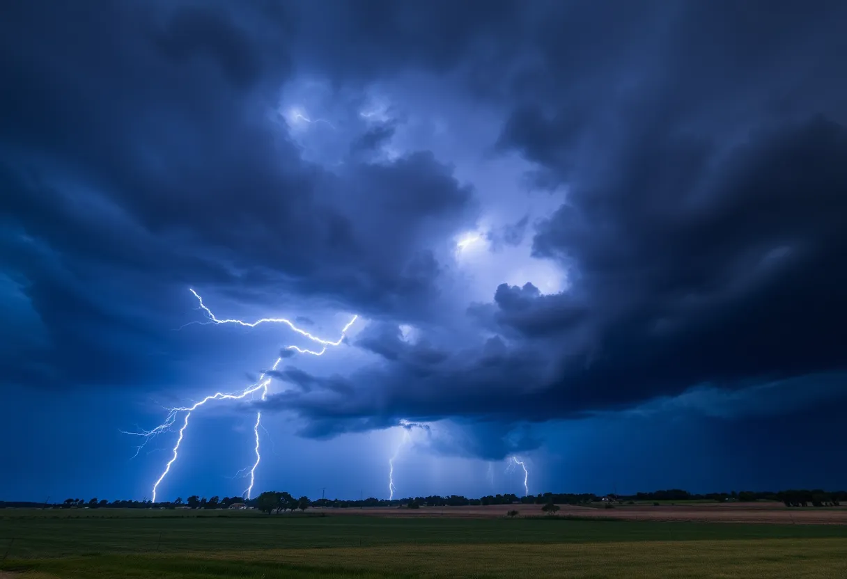
Statistics indicate that lightning strikes approximately 25 million times across the United States each year, with most strikes occurring during summer months, ultimately resulting in around 20 fatalities annually. The intensity of lightning increases as a thunderstorm approaches and peaks at the moment the storm is overhead, decreasing once the storm departs.
Residents are advised to stay informed about safety recommendations for severe weather. It is critical to find shelter indoors to ensure personal safety during thunderstorms. Wet roads can lead to dangerous driving conditions, causing hydroplaning scenarios when water accumulates ahead of a vehicle’s tires faster than it can be displaced.
Additionally, the National Hurricane Center (NHC) is monitoring two weather systems in the Atlantic, named Invest 97L and Invest 96L, which may evolve into tropical depressions next week. Invest 97L has emerged as a low-pressure area associated with a tropical wave and currently exhibits maximum winds of 35 mph, with a high likelihood of further development. Meanwhile, Invest 96L shows disorganized showers and thunderstorms but possesses a lower chance of formation.
The upcoming named storms for the Atlantic hurricane season are projected to be Erin and Fernand. The peak months for hurricane activity span from mid-August through mid-October. Notably, 97% of tropical cyclone occurrences take place between June 1 and November 30 every year.
To enhance hurricane preparedness, Florida residents recently gained the benefit of certain hurricane supplies being permanently tax-free as of August 1. As the Atlantic hurricane season continues through to November 30, maintaining a state of readiness is critical for individuals and families living in vulnerable areas.
In conclusion, as the NWS alert emphasizes, safety precautions during thunderstorms are paramount. Residents should continue to monitor for updates regarding severe weather conditions and remain cautious as they navigate this stormy period in Laurens and Greenwood counties.
Deeper Dive: News & Info About This Topic
HERE Resources
Severe Thunderstorm Warning Issued for Laurens and Greenwood Counties
Thunderstorm Alert Issued for Laurens and Greenwood Counties
Multiple Arrests Made in Fatal Shooting at Ware Shoals Dragway
Flash Flood Warning Issued for Abbeville and Greenwood
Flood Warning Issued for South Carolina Counties
Flash Flood Warning Issued for Abbeville and Greenwood Counties
McCormick, South Carolina Faces Severe Flood Risks from Heavy Rainfall
Flood Advisory Issued for Abbeville and Greenwood Counties
Tragic Drowning in Strom Thurmond Lake Raises Safety Concerns
Weather in Greenwood, SC: Thunderstorms Expected
Additional Resources
- Naples News
- Wikipedia: Tropical cyclone
- Watauga Online
- Google Search: thunderstorm safety
- Island Packet
- Google Scholar: severe weather events
- The State
- Encyclopedia Britannica: thunderstorm
- WAOW
- Google News: tropical depression