News Summary
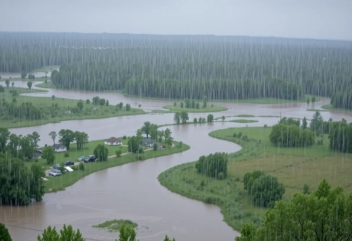
Residents of McCormick County, South Carolina, are facing a Flood Advisory due to heavy rainfall that has already caused 1 to 2 inches of rain and is expected to continue. Areas with poor drainage and low-lying regions are at risk, particularly in towns such as McCormick, Plum Branch, and Whitetown. A Flash Flood Warning is also active for nearby counties, raising concerns about flash flooding. Authorities urge residents to stay informed and to avoid driving through flooded roadways.
McCormick, South Carolina Faces Severe Flood Risks from Heavy Rainfall
A Flood Advisory is currently in effect for McCormick County, South Carolina, and Lincoln County, Georgia, running until 7:45 AM EDT on August 5, 2025. This advisory warns residents to be alert for flooding caused by excessive rainfall, particularly in low-lying areas and locations with poor drainage.
As of 5:51 AM EDT, Doppler radar indicated that 1 to 2 inches of rain had already fallen in the impacted areas, with an additional 1 to 2 inches expected. Flooding is anticipated in towns and regions including McCormick, McCormick County Airport, Plum Branch, Hawe Creek Campground, Whitetown, Knox Scout Reservation, Double Branches, New Hope, and Cherokee Boat Ramp.
Residents are advised to never drive through flooded roadways and to evacuate to higher ground if they live in particularly flood-prone areas. Those who find themselves trapped by fast-moving waters are urged to call 911 for emergency assistance.
Flash Flood Warning Issued
In addition to the flood advisory, a Flash Flood Warning is active for eastern Abbeville County and northwestern Greenwood County in South Carolina until 9:15 AM EDT. Heavy rainfall has already resulted in 2 to 3.5 inches since 3 AM, with an additional inch expected, creating a high risk for flash flooding.
Areas potentially affected by flash flooding include Long Cane Creek, McCord Creek, Keller Branch, and urban regions within Greenwood and Abbeville. Cities at risk include Greenwood, Abbeville, Ware Shoals, Cokesbury, Hodges, Shoals Junction, and Promised Land.
Georgian Flood Watch Continues
A Flood Watch remains in effect throughout the day in various regions of Georgia, signaling the possibility of flooding due to excessive rainfall. An expected accumulation of 1 to 3 inches of rain may exacerbate flooding risks.
North and central Georgia will experience a persistent moist air mass, resulting in multiple rounds of rain and thunderstorms. Severe flooding is anticipated in urban areas and low-lying regions, especially around rivers, creeks, and streams.
Safety Precautions and Reporting
Officials are emphasizing the life-threatening nature of flooding. Residents are urged to stay informed by monitoring local weather forecasts and to heed evacuation recommendations if issued. It is also important for the public to report any flooding incidents or landslides that threaten roadways to the National Weather Service (NWS).
Given the dangerous conditions posed by flooding, it is crucial for individuals to avoid walking or driving through flooded areas to ensure personal safety and reduce risks to emergency responders.
Deeper Dive: News & Info About This Topic
HERE Resources
Tragic Drowning in Strom Thurmond Lake Raises Safety Concerns
Additional Resources
- Island Packet: Flood Advisory in McCormick County
- Google Search: Flood Advisory McCormick County
- SC Daily Gazette: Storm Helene Updates
- Encyclopedia Britannica: Hurricane Helene
- The State: Weather News and Updates
- Google News: Severe Flooding South Carolina
- Post and Courier: Baby Boomers Crisis in SC
- NBC News: Live Updates on Storm Helene
- WYFF4: Helene Flooding Live Updates