News Summary
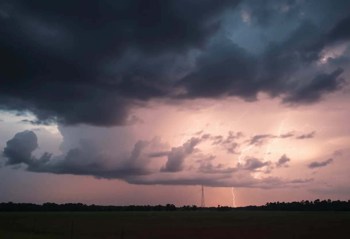
Residents in Upstate South Carolina and Western North Carolina are on high alert following a severe thunderstorm warning issued by the National Weather Service. Wind gusts may reach 60 mph, and hail could be as large as 0.75 inches. Various counties including Greenville, Spartanburg, and Laurens are advised to take precautions and remain indoors. The storm is moving quickly and may cause significant damage. Stay informed and follow NWS alerts for updates.
Severe Thunderstorm Warning in Upstate South Carolina and Western North Carolina
Residents of Upstate South Carolina and Western North Carolina are on alert as a severe thunderstorm warning was issued at 8:12 p.m. on June 17. The National Weather Service (NWS) out of Greenville-Spartanburg has flagged a number of counties as being at risk, and the impacts could be significant. This is no time to take chances!
Counties Affected
So, just who needs to pay extra close attention? This warning stretches across quite a few areas, including:
- Elbert
- Hart
- Henderson
- Polk
- Transylvania
- Abbeville
- Anderson
- Greenville
- Oconee
- Pickens
- Rutherford
- Cleveland
- Laurens
- Union
- Spartanburg
- Cherokee
- Greenwood
What to Expect
This storm isn’t just your average rain cloud. Meteorologists are warning of wind gusts that could hit as high as 60 mph. That’s enough to send tree branches flying and, potentially, cause damage to power lines. Keep an eye on the skies, because hail is also on the menu, with sizes reaching up to 0.75 inches!
Safety First!
In light of these warnings, it’s essential for residents to take precautions. A smart move is to relocate to an interior room on the lowest floor of your home to keep safe from the strong winds and potential hail. If you do see any damaging winds, hail, or flooding, report it directly to the NWS. They’ve set up a toll-free hotline at 800-267-8101, and you can follow along on their social media too.
Storm Movement and Timing
As of 8:49 p.m. EDT, radar showed that severe thunderstorms were beginning to form along a line stretching from:
- 12 miles south of Hendersonville
- 18 miles southwest of Columbus
- 7 miles south of Greenville Downtown
- 11 miles north of Abbeville
The storms were moving rapidly northeast at 50 mph, meaning they’ll be upon various towns before you know it! Notably, areas like Greenville Downtown, Spartanburg, and Laurens could see the worst of it.
Stay Updated
The NWS has stated that the warning is set to remain in effect until at least 9:45 p.m. EDT for several counties. They’ve also been issuing additional warnings for others until 9:15 p.m. EDT. While the strong storms prompted warnings for Chester and York counties, let’s hope they weaken before reaching those areas.
A Little Thunderstorm 101
Just so you know, a severe thunderstorm warning means we’re dealing with winds of 58 mph or higher, or hail that’s an inch or larger. Did you know that in the U.S., lightning strikes occur roughly 25 million times each year, mostly during those hot summer months? That’s why staying safe indoors during these storms is so vital.
Driving Precautions
If you must travel during this storm, watch out for hydroplaning. That’s when vehicles lose traction and slide uncontrollably on wet roads. It can happen when water builds up on the pavement, making it super dangerous to drive.
Final Thoughts
As this storm moves in, stay aware and prioritize your safety. Follow the NWS alerts, check in with your neighbors, and wait for the skies to clear before heading back out. Weathering the storm is always the best plan!
Deeper Dive: News & Info About This Topic
HERE Resources
Severe Storms Cause Devastation in Augusta Area
Shane Goodwin Appointed Superintendent of Greenwood County Schools
Severe Thunderstorm Alert for Greenwood and Surrounding Areas
Severe Thunderstorm Warnings Issued Across Upstate South Carolina
Greenwood County Enhances Hurricane Preparedness with Grant
Severe Thunderstorm Warnings Issued for Upstate South Carolina
Severe Thunderstorm Alert in Abbeville County
Indiana Faces Severe Weather: Tornado Watches and Thunderstorm Warnings Issued
Severe Storms Cause Power Outages in Upstate SC and WNC
Severe Thunderstorm Hits Greenwood, SC Causing Damage
Additional Resources
- Greenville Online: Severe Thunderstorm Warning
- Herald Online: Weather News
- WYFF 4: Severe Weather Timing
- Wikipedia: Thunderstorm
- Fox Carolina: Severe Thunderstorm Warning Issued
- Google Search: Severe Thunderstorm Warning
- Post & Courier: Severe Weather Weekend
- Encyclopedia Britannica: Thunderstorm
- Independent Mail: Severe Thunderstorm Warning for Anderson County
- Google News: Severe Weather Alert