News Summary
The National Weather Service has lifted the severe thunderstorm warning for Abbeville and Greenwood counties as the storm weakens. Residents can feel relieved as the immediate threat to life and property has passed. However, a new alert for strong thunderstorms is active until 9:45 p.m., impacting Abbeville, Laurens, Union, and Greenwood counties, with wind gusts up to 40 mph expected. Caution is advised for those in the area, especially with potential slippery conditions ahead due to an upcoming winter storm watch.
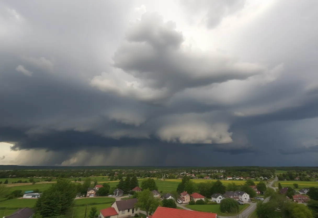
Severe Thunderstorm Warning Expired as Storm Weakens Over Abbeville and Greenwood Counties
Abbeville – It looks like the weather has taken a turn for the better in Abbeville and Greenwood counties, as the National Weather Service has just announced that the severe thunderstorm warning has officially expired. The storm that was climbing to concerning levels has weakened below severe limits, meaning there’s no longer an immediate threat to life or property in the area. That’s some welcome news for residents!
As of 9:15 p.m., the warning that had been keeping folks on alert has come to an end. However, for those still watching the skies, the NWS has issued an updated weather alert for strong thunderstorms lasting until 9:45 p.m. This updated alert now covers not just Abbeville but also Laurens, Union, and Greenwood counties, reminding everyone to stay informed.
What to Expect with the Updated Alert
For those in the affected areas, get ready for some wind gusts up to 40 mph. Stay cautious! Doppler radar has been tracking strong thunderstorms in a line moving from 6 miles southwest of Union to about 4 miles west of Greenwood. As these storms make their way east at a speed of 35 mph, it’s essential to keep an eye on the weather and stay prepared.
With gusty winds blowing through, there’s a chance that tree limbs might come crashing down, and unsecured outdoor belongings could take flight! Areas like Coronaca, Cross Hill, Lake Greenwood State Park, Mountville, and many more should remain cautious.
Staying Safe During Thunderstorms
If you’re outdoors and see dark clouds rolling in, the first thing to do is find shelter inside a sturdy building. The power of lightning is no joke—did you know that the United States experiences approximately 25 million lightning strikes each year? Most of these strikes occur during summer thunderstorms, and sadly, about 20 fatalities occur annually due to lightning. When thunderstorms roll in, the chance of being struck increases, peaks when the storm is overhead, and lessens as it moves away.
While lightning is something to be wary of, another weather phenomenon to be mindful of is hydroplaning. This can happen if you’re driving during a storm, which can lead to some scary situations on the road. Hydroplaning occurs when a vehicle slides uncontrollably over water buildup, resulting in a loss of control. The conditions that contribute to hydroplaning include wet roads, worn-out tires, and driving too fast for the conditions.
What Lies Ahead: Winter Storm Watch
As if the thunderstorms weren’t enough, a winter storm watch has also been issued for the area! With colder temperatures leading up to the storm, residents should brace for potential sleet, snow, and ice accumulations that could create hazardous travel conditions over the next few days. Right after 9 AM, snow showers are expected to move into the western mountains and northeast Georgia, turning widespread by noon.
Get ready, folks in the southern Upstate, as sleet and freezing rain are on the way, particularly impacting areas like Abbeville and Greenwood. Accumulations could see up to 1-3 inches of snow in northern and central locations, along with about 0.25 inches of ice in the southern regions. This icy layer could lead to slippery roads, especially on bridges and elevated surfaces.
What’s the Plan?
As the weather continues to evolve, the snow and freezing rain are anticipated to taper off by around 2 AM in most regions. However, it is important to note that roadways may remain dangerously snowy and icy for several hours until temperatures finally rise above freezing—expected between 10 AM and 11 AM on Saturday. Watch out for the potential of black ice forming overnight into Sunday due to lingering moisture or refrozen melted snow.
Keep your loved ones safe, stay alert to evolving weather updates, and remember to always have an emergency plan in place for inclement weather. It’s always better to be prepared!
Deeper Dive: News & Info About This Topic
HERE Resources
Spring Weather Whiplash Hits Spartanburg, SC!
Severe Thunderstorm Warning Hits Anderson and Abbeville Counties
Greenwood County Launches Project for Safer Roads
Severe Weather Hits Columbia: Tornado and Thunderstorm Warnings
Central US Faces Severe Weather and Flooding Risks
Severe Tornado Outbreak Causes Widespread Destruction Across U.S.
Severe Weather Alert: Tornado Warning in Edgefield and Saluda
Upstate South Carolina Schools Transition to eLearning Days
Tragic Incident in Greenville: Young Woman Shot by Deputies
Greenwood Firefighters Tackle Early Morning House Fire
Additional Resources
- Herald Online: Severe Weather Update
- Wikipedia: Weather Warning
- Island Packet: Weather Alerts
- Google Search: Thunderstorm Safety
- WYFF4: Tornado Warnings
- Google Scholar: Severe Weather Impacts
- Fox Carolina: Winter Weather Forecast
- Encyclopedia Britannica: Winter Storms
- Salisbury Post: Winter Storm Warning
- Google News: Winter Storm Alerts