News Summary
Residents of Abbeville and Greenwood counties are urged to prepare as powerful thunderstorms approach the area. The National Weather Service issued a thunderstorm warning advising about strong winds and potential hail. With gusts reaching 40 mph and marble-sized hail expected, it is important for residents to secure outdoor belongings and seek shelter. The warning is in effect until 2:30 p.m. Saturday, with residents in designated areas encouraged to stay informed and prioritize safety.
Thunderstorm Alert in Abbeville and Greenwood Counties
Residents of Abbeville and Greenwood counties received a timely alert as powerful thunderstorms approached their area. The National Weather Service (NWS) for the Greenville-Spartanburg region issued the thunderstorm warning at 2:02 p.m. on Saturday, advising everyone to stay alert for potential weather disruptions.
Be Prepared for Strong Winds and Hail
The alert is set to stay in effect until 2:30 p.m., giving folks a narrow window to prepare for the storm. The NWS indicated that wind gusts could reach up to 40 mph, alongside the likelihood of experiencing marble-sized hail measuring around 0.5 inches. So, if you have any outdoor plans, it might be wise to rethink them for the time being!
Doppler radar picked up on a strong storm brewing just before the alert was issued, detecting it over Abbeville and moving northeast at around 30 mph.
What to Watch Out For
With gusty winds like these, there could be some minor disturbances. The NWS pointed out that tree limbs might get knocked down, and any loose outdoor items could be tossed about. Hail, while a common sight during these storms, can potentially cause minor damage to your outdoor belongings. Therefore, make sure your vehicles and patio furniture are secured!
Designated Areas Under Alert
The warning covers several locations, including:
– Hodges
– Donalds
– Abbeville
– Shoals Junction
– Cokesbury
– Due West
– Ware Shoals
– Lake Greenwood
For those outside, the advice is clear: seek shelter inside a building. Safety is the number one priority, and it’s always better to be safe than sorry when weather conditions turn severe!
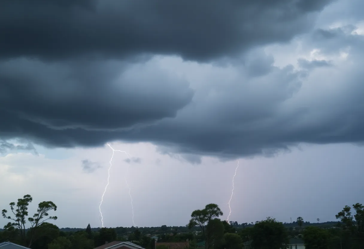
Thunderstorm and Lightning Facts
Did you know that approximately 25 million lightning strikes hit the United States each year, particularly in the summer months? Lightning is no joke – it causes about 20 fatalities annually, underscoring the importance of being aware of surrounding weather conditions. The risk of these strikes increases significantly as a thunderstorm rolls in and peaks while the storm is directly overhead.
Stay Safe on the Roads
If you’re planning to drive during this storm, be extra cautious. Anyone out on the roads should be aware of the danger of hydroplaning. This occurs when your vehicle slides uncontrollably on wet surfaces due to water buildup in front of your tires. The NWS points out that three key factors contribute to this slippery situation.
If you find yourself without shelter during a storm, there are specific safety guidelines to follow. Stay low, avoid contact with metal, and stay away from windows if possible.
Re-assessing Earlier Alerts and Updates
Furthermore, another alert was logged at 12:59 a.m. on Saturday for Cherokee, Anderson, and several other counties, lasting until 1:30 a.m.. These earlier storms reported gusts of up to 50 mph and pea-sized hail around 0.25 inches.
As residents in Abbeville and Greenwood counties remain vigilant, it’s essential to keep updated on the weather and prepare accordingly. Storms are a reminder of nature’s power, so let’s stay safe and sheltered!
Deeper Dive: News & Info About This Topic
HERE Resources
Severe Thunderstorms Hit South Carolina
Beloved Abbeville Resident Georgia Satcher Scott Passes Away
Severe Thunderstorm Warning Issued for Greenwood and Laurens Counties
Severe Thunderstorm Warning Issued for Greenwood County
Greenwood Man Dies in Officer-Involved Shooting
Greenwood Community Mourns Loss from Officer-Involved Shooting
Severe Weather Alert: Tornado Risks Extend Across Upper Midwest
Severe Weather Alert: Thunderstorms and Tornado Watch in Greenwood County
Severe Thunderstorm Hits Greenwood County: Be Prepared!
Severe Thunderstorm Warning Issues for Greenwood County
Additional Resources
- Myrtle Beach Online
- Wikipedia: Thunderstorm
- The State
- Google Search: Thunderstorm Warning
- Island Packet
- Google Scholar: Weather Alerts
- WYFF4
- Encyclopedia Britannica: Weather
- Fox Carolina
- Google News: Abbeville Weather