
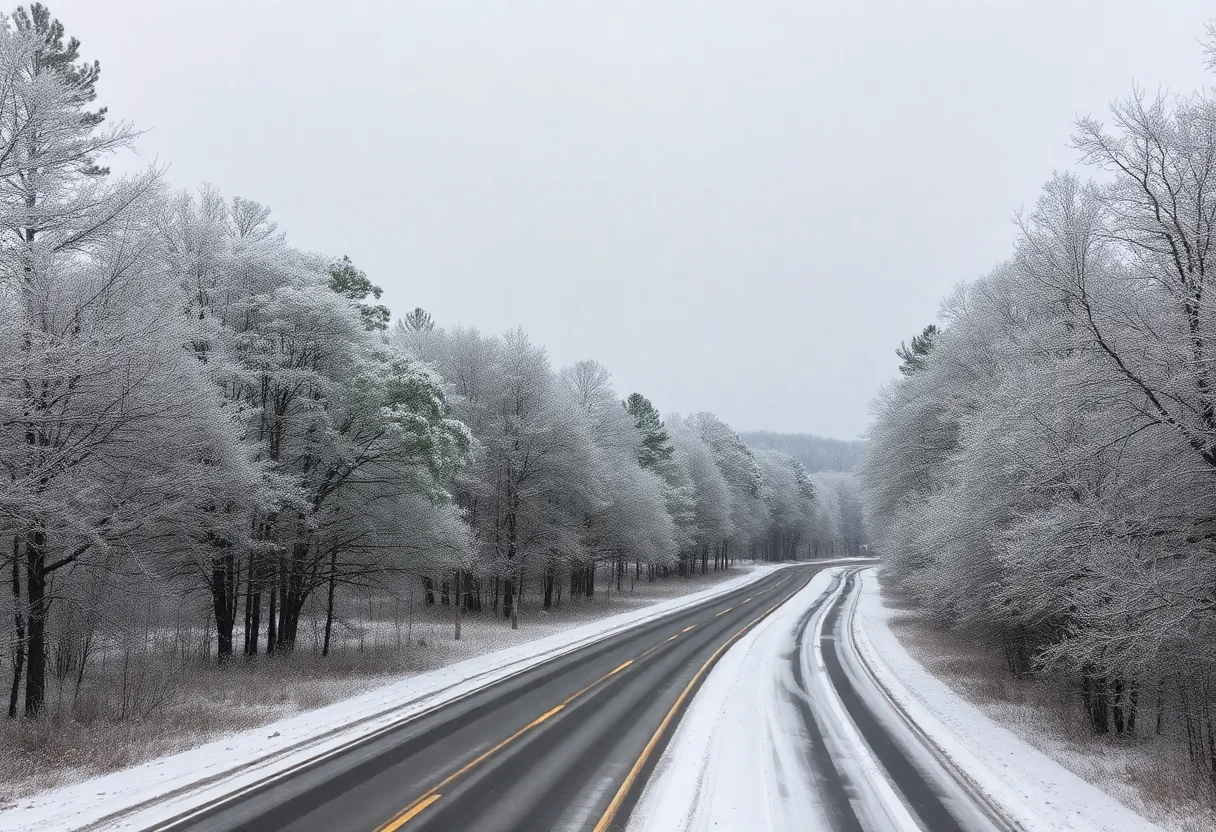
A serene view of winter weather affecting South Carolina, showcasing snow-covered areas.
Want to target the right audience? Sponsor our site and choose your specific industry to connect with a relevant audience.
Prominent brand mentions across targeted, industry-focused articles
High-visibility placements that speak directly to an engaged local audience
Guaranteed coverage that maximizes exposure and reinforces your brand presence
Interested in seeing what sponsored content looks like on our platform?
May’s Roofing & Contracting
Forwal Construction
NSC Clips
Real Internet Sales
Suited
Florida4Golf
Click the button below to sponsor our articles:
Sponsor Our ArticlesSouth Carolina is preparing for a winter weather event as a winter weather advisory is issued, forecasting snow and ice accumulation midweek. With temperatures plummeting, snow showers are expected to create hazardous conditions. Residents are urged to dress in layers and take precautions against freezing temperatures. A winter storm watch is also in place for later in the week, potentially leading to challenging travel conditions. The weather is expected to improve by the weekend, but risks of black ice remain a concern.
South Carolina is bracing for a winter weather event as a winter weather advisory has been issued in anticipation of snow and ice accumulating midweek. Snow showers began Tuesday afternoon along and south of Interstate 85, with expectations for continued flurries until around 7 p.m. Tuesday. Accumulations in areas south of I-85 are forecasted to range from a quick dusting up to 1 inch.
Temperatures across the region are expected to plummet, with lows dropping to 14°F in the Upstate and a chilling 5°F in Asheville. Wednesday is anticipated to be a sunny yet frigid day, with temperatures hovering near the freezing mark. The forecast indicates that Thursday will see a slight warm-up, with temperatures expected to reach around 40°F. By Friday through Sunday, temperatures may rise into the mid-40s.
Residents are advised to adopt safety measures against freezing temperatures by dressing in multiple layers and ensuring that extremities are covered if spending extended time outdoors. These precautions are especially important for individuals who have previously experienced issues with frozen pipes.
A winter storm watch is in place for Friday, signaling potential sleet, snow, and ice accumulations that could make travel hazardous. Thursday morning could see dangerously cold conditions with temperatures in the teens and 20s, compounded by winds in the mountainous regions reaching 10 to 15 mph, and gusts as high as 30 mph. This could create feels-like temperatures dipping into single digits or below zero throughout the area.
Snow showers are expected to advance into the western mountains and northeast Georgia after 9 AM Wednesday, becoming widespread across the Western Carolinas by noon. The initial precipitation is likely to start as snow, transitioning into the afternoon and early evening hours, before a potential switch to sleet and freezing rain for southern Upstate areas after 6 PM. Northern and central Upstate regions may see total snow accumulations ranging from 1 to 3 inches, while southern Upstate locations could accumulate a trace up to 2 inches. Ice accumulation in southern Upstate areas is projected to be as much as 0.25 inches.
Western North Carolina may bear the brunt of the storm, with predictions for snow totals reaching 3 to 6 inches, prompting a winter storm watch for these areas. By late Wednesday night, the snow and freezing rain are expected to taper off, with conditions improving by about 2 AM for most regions. However, road conditions are likely to remain challenging and icy into Saturday morning until temperatures climb above freezing, with warming projected between 10 AM and 11 AM on Saturday.
The potential for black ice is a concern Saturday night into Sunday as lingering moisture or melted snow may refreeze. A winter weather advisory specifically for the Midlands, including Kershaw and Lee counties, will take effect at 11 a.m. Wednesday as rain is expected to precede any snow or wintry mix, which may include freezing rain and sleet.
Columbia is forecasted to see an overnight low of 19 degrees, potentially leading to further concerns regarding refreeze and black ice. Over the following days, daytime temperatures are projected to rise from the 40s on Thursday and Friday to the 50s throughout the weekend. Looking further ahead, a heat wave is anticipated early next week, with temperatures possibly reaching up to 71 degrees.
This possible snow event could mark the third snowstorm in 2025 for the Midlands, with the last recorded snowfall in Columbia occurring in January 2022, alongside significant snowfall earlier in January 2025.
News Summary President Trump has signed the GENIUS Act, the first major federal legislation aimed…
News Summary The U.S. Secretary of State has revoked the visa of Brazilian Supreme Court…
News Summary Western Virginia faced severe flash flooding as sudden torrential rains caused hazardous conditions,…
News Summary The Los Angeles County Sheriff's Department mourns the loss of three veteran deputies,…
News Summary A chaotic shooting during a Juneteenth celebration in Anderson County has left one…
News Summary South Carolina is currently in a state of emergency as Governor Henry McMaster…