News Summary
A severe thunderstorm watch has been issued for several counties in South Carolina, including Greenville and Spartanburg. Residents are advised to seek shelter as storms may produce wind gusts up to 50 mph and pea-sized hail. Updated alerts warn of risks including flooding and lightning, reminding citizens to remain vigilant and safe.
Severe Thunderstorm Watch Hits South Carolina
Greenville, SC – A severe thunderstorm watch has been issued by the National Weather Service for multiple counties in South Carolina, including Greenville, Greenwood, Laurens, Spartanburg, and Union, effective Saturday evening and extending until 11 p.m. The watch was announced at 7:17 p.m., making it clear that residents should be on alert for possibly severe storms.
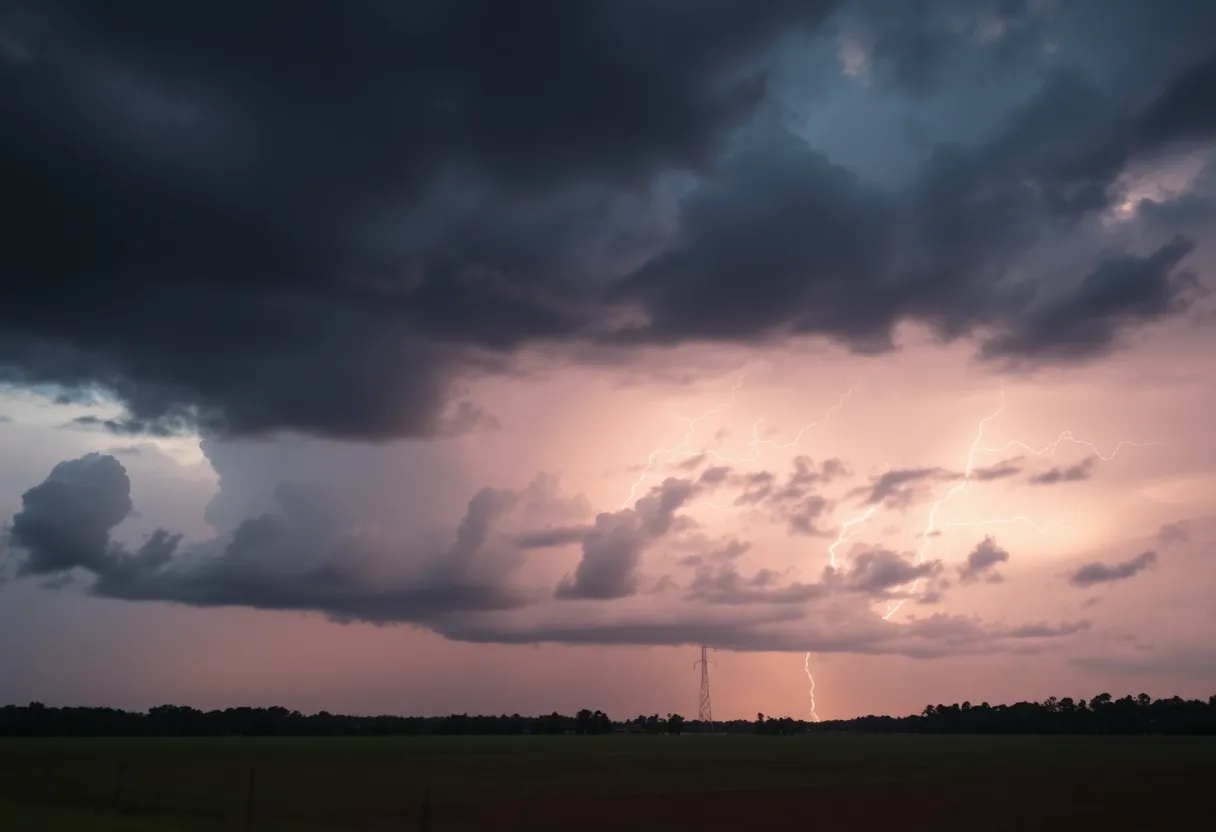
When Thunder Strikes
Did you know that lightning strikes the United States a whopping 25 million times each year? While most of these strikes occur during the summer months, they still pose a serious risk, claiming around 20 lives annually, according to the National Weather Service. As storms approach, the likelihood of lightning increases and peaks right above your head, so it’s essential to stay grounded—literally and figuratively!
Stay Safe Inside
As the storm clouds gather, it’s crucial to remember that your safety comes first. The NWS recommends seeking shelter indoors whenever possible. This isn’t just about staying dry; it’s also about keeping safe from the dangers lurking in the sky. Hydroplaning can be a significant risk since it occurs when a vehicle loses traction on wet roads, typically when water buildup in front of the tires happens faster than the weight of the vehicle can push it away. So if you’re out driving, slow down and keep an eye on road conditions.
Storm Updates from the Weekend
An updated weather report was issued shortly after the initial watch at 7:47 p.m. on Friday, warning of strong thunderstorms until 8:30 p.m. in areas like Greater Pickens and Greenville County. The storms are predicted to bring pea-sized hail (0.25 inches) and wind gusts reaching up to 50 mph. To give you a sense of proximity, Doppler radar tracked a strong thunderstorm only 12 miles northwest of downtown Greenville, particularly near Slater-Marietta, moving eastward at a brisk pace of 25 mph.
Gusty winds related to these storms also have the potential to knock down tree limbs and blow around unsecured outdoor objects. The areas most affected include Traveler’s Rest, Slater-Marietta, Tigerville, and several beautiful state parks like Caesars Head and Paris Mountain. If you find yourself outside during these storms, it’s imperative to head indoors as quickly as possible.
Additional Alerts Issued
More Storms Expected
As if that wasn’t enough, another alert was released on Sunday at 5:33 p.m. for strong thunderstorms until 6 p.m. in Greenville and Spartanburg counties. Storms during this time were expected to produce more pea-sized hail and wind gusts up to 40 mph. Doppler radar identified a significant thunderstorm 13 miles northeast of downtown Greenville, near Greer, moving southeast at 30 mph. Areas affected from this alert included Reidville, Moore, and Lyman among others.
To wrap things up, it’s clear that South Carolina residents should remain cautious and prepared as storms continue to roll through. Staying informed, seeking shelter, and taking care while driving are ways to keep yourself and your loved ones safe. Don’t underestimate the power of Mother Nature; she can be quite unpredictable!
Deeper Dive: News & Info About This Topic
HERE Resources
Severe Thunderstorm Watch Issued for South Carolina
Greenwood Man Charged with Attempted Murder in Shooting Incident
Shooting Incident Shakes Greenwood Community
Shooting Incident Leaves One Man Seriously Injured in Greenwood
Severe Thunderstorm Warnings Issued for Greenwood County
Severe Thunderstorms Prompt Weather Alerts in Greenwood County
FC Tulsa Hosts Greenwood Night to Honor Community
Severe Thunderstorms Disrupt Greenwood County
Severe Thunderstorm Watch Issued for South Carolina
Severe Weather Alert: Strong Storms Approaching Central NC
Additional Resources
- Island Packet
- Wikipedia: Thunderstorm
- The State
- Google Search: Severe Thunderstorm Watch South Carolina
- Herald Online
- Encyclopedia Britannica: Lightning
- Myrtle Beach Online
- Google News: South Carolina Weather Alerts
- Greenville Online
- Encyclopedia Britannica: Hail
- WYFF4