


BREAKING NEWS
Greenwood Basketball Teams Face Mixed Outcomes in Recent Games
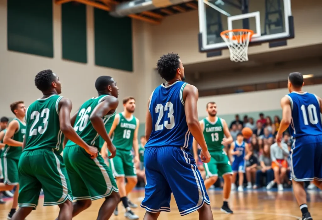
Greenwood, September 22, 2025 News Summary In a recent round of games, Greenwood’s basketball teams experienced starkly different results. The girls’ team narrowly lost 49-47 in overtime against Greenville, despite a...

Anderson University Football Team Faces First Defeat of the Season
Anderson, South Carolina, September 21, 2025 News Summary Anderson University football team ended their unbeaten streak with a 21-14 loss against Mars Hill. Multiple lightning delays disrupted the game, but standout...

Whitmire Wolverines Drop to 2-2 After Loss to Greenwood Christian
Whitmire, South Carolina, September 20, 2025 News Summary The Whitmire Wolverines football team has suffered a second consecutive loss, dropping their season record to 2-2 after a defeat by Greenwood Christian...

Legal Dispute Over $200,000 Cargo Theft in Greenwood
Greenwood, September 19, 2025 News Summary Bay Island Sportswear, Inc. and Wildcat Retro Brands, LLC are embroiled in a legal battle concerning a theft claim of cargo valued at $200,000. The...
David Stumbo Announces Candidacy for Attorney General
Laurens, South Carolina, September 18, 2025 News Summary David Stumbo, the Eighth Circuit Solicitor, has declared his candidacy for South Carolina’s attorney general position. Stumbo aims to be tough on crime,...

Greenwood Man Sentenced to 45 Years for Murder
Greenwood, September 18, 2025 News Summary Ahmad Daterius Evans, a 23-year-old from Greenwood, has received a 45-year prison sentence for murder and attempted murder linked to a shooting incident. The tragic...
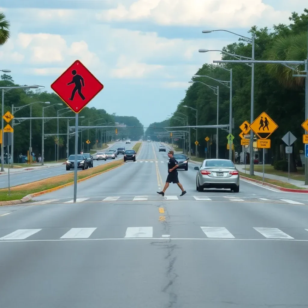
Concerns Rise Over Pedestrian Safety in South Carolina
Greenwood, South Carolina, September 17, 2025 News Summary Two recent fatal pedestrian accidents in South Carolina have sparked major concerns about pedestrian safety. A woman was struck by a pickup truck...
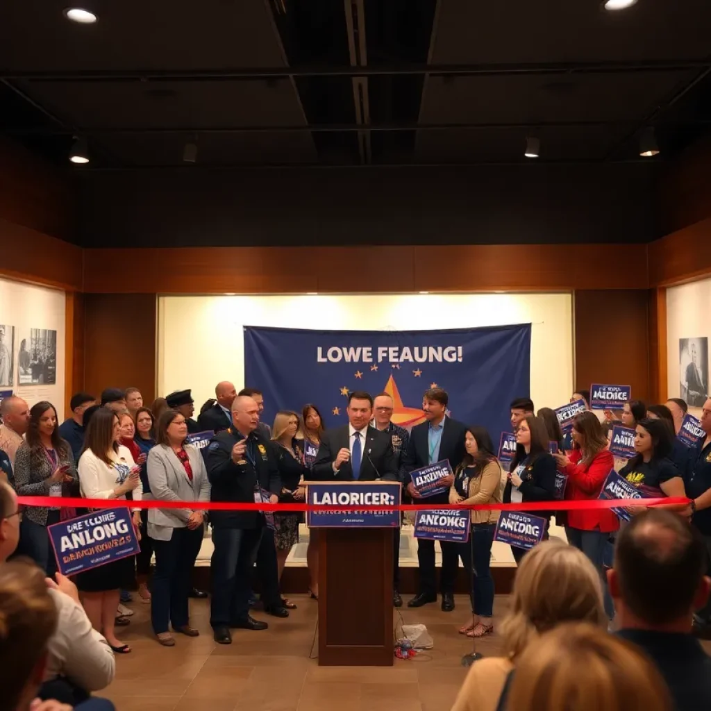
David Stumbo Launches Campaign for Attorney General
Greenwood, September 17, 2025 News Summary David Stumbo, a well-known prosecutor from Greenwood, has officially announced his candidacy for Attorney General of South Carolina. During the launch at Laurens County Museum,...

19-Year-Old Sentenced for Armed Robberies in Greenwood
Greenwood, S.C., September 17, 2025 News Summary Ty’rez Aunteavious Thomas, 19, was sentenced to 35 years in prison for a series of armed robberies in Greenwood, S.C. He lured victims via...
BUSINESS

New Industrial Facility Construction Announced in Greenwood County
Greenwood County, South Carolina, September 19, 2025 News Summary THS Constructors Inc. has been selected to build a new 108,000 square-foot industrial speculative facility in Greenwood County. Set to start construction...

Greenwood County Selects THS Constructors for New Industrial Facility
Greenwood County, September 17, 2025 News Summary Greenwood County has chosen THS Constructors, Inc. to build a new 108,000-square-foot industrial facility, starting construction in September 2025. The facility will feature a...

Harbin Clinic Family Medicine Expands with Dr. Megna
Rome, Georgia, September 12, 2025 News Summary Harbin Clinic Family Medicine in Rome, Georgia, has welcomed Dr. Gerald “JP” Megna to its team, enhancing family medicine and sports medicine services. Starting...

Greenwood Welcomes First Whataburger Location
Greenwood, SC, September 12, 2025 News Summary Greenwood, South Carolina, has opened its first Whataburger location, featuring 24-hour service. The new restaurant aims to enhance the local dining scene by employing...

South Carolina Homeowners Prepare for Fall Maintenance
South Carolina, September 11, 2025 News Summary As fall approaches in Upstate South Carolina, homeowners are advised to perform key maintenance tasks to protect their properties from potential heavy rainfall. Essential...

Crookston Welcomes Dr. Ian Glidden to RiverView Health
Crookston, MN, September 10, 2025 News Summary RiverView Health in Crookston, MN, has welcomed Dr. Ian Glidden, a Family Medicine provider, to its medical staff. With qualifications from Ross University and...

Exploring South Carolina’s Vibrant Town Squares
South Carolina, August 24, 2025 News Summary South Carolina’s town squares are vital community spaces, rich in history and culture. From Abbeville’s historic sites to Greenwood’s Festival of Flowers, these squares...
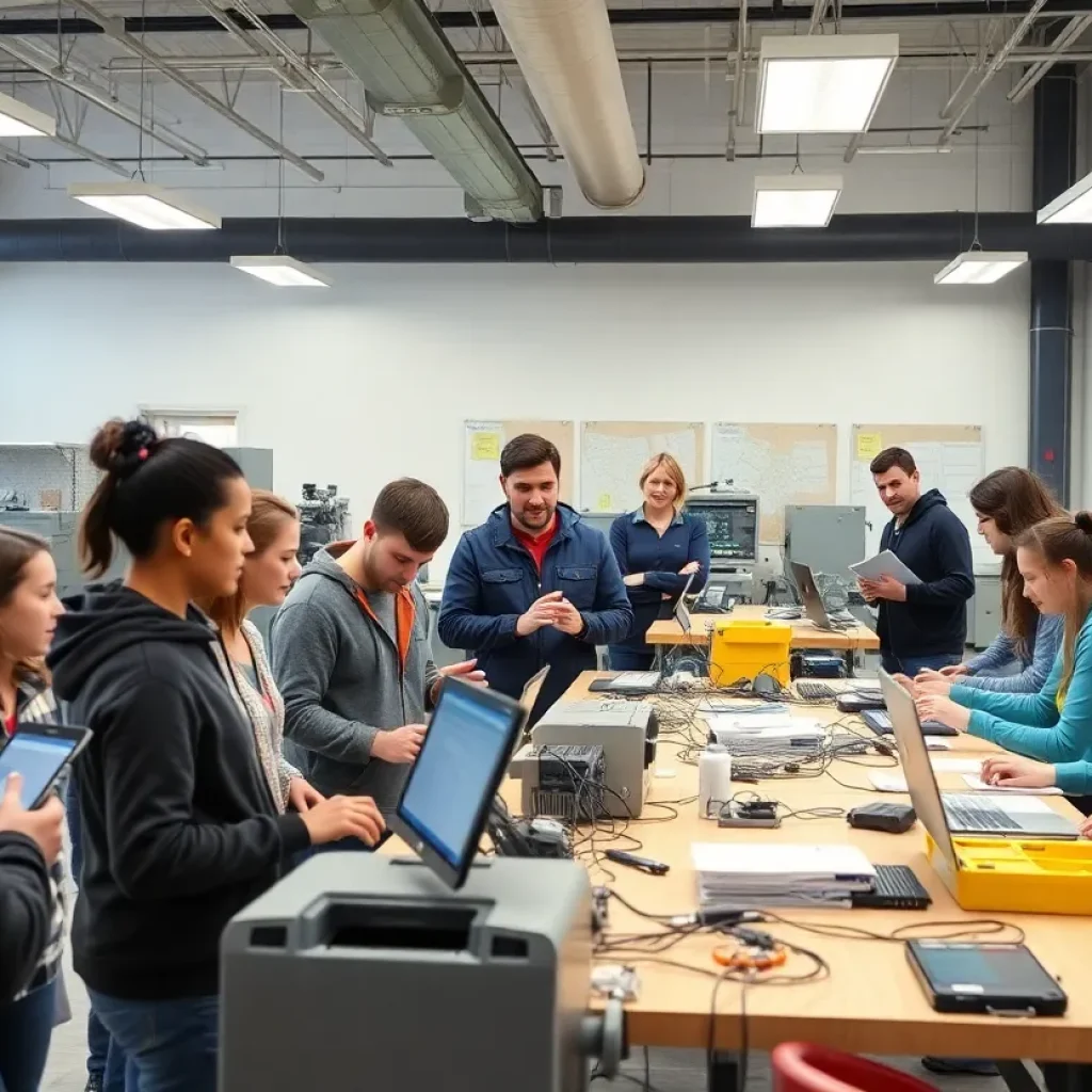
Greenwood County Launches New Technical Innovation Center
Greenwood County, August 19, 2025 News Summary Greenwood County, in collaboration with Piedmont Technical College and local school districts, has announced the launch of a new Technical Innovation Center. This facility...

Severe Thunderstorm Causes Damage and Disruptions in Greenwood
News Summary Greenwood, SC, faced severe thunderstorms resulting in substantial tree damage and power outages. The storm brought wind gusts of up to 40 mph and pea-sized hail. Authorities issued...
Events/What's Happening

T.L. Hanna Edges Out Greenwood in Thrilling Matchup
Anderson, SC, September 22, 2025 News Summary In a closely contested football game, T.L. Hanna emerged victorious over Greenwood with a score of 22-21. This win marks T.L. Hanna’s third straight...

Greenwood Christian Hawks Triumph Over Orangeburg Prep
Greenwood, SC, September 22, 2025 News Summary The Greenwood Christian Hawks celebrated a 34-21 victory against Orangeburg Prep, achieving their third consecutive win. Improving their season record to 5-1, the Hawks...

Greenwood Eagles Secure Fourth Consecutive Win
Greenwood, September 22, 2025 News Summary The Greenwood Eagles triumphed over the Batesburg-Leesville Panthers with a score of 2-0, marking their fourth consecutive victory. This win improves their season record to...

Greenwood Eagles Secure Third Straight Victory
Greenwood, SC, September 22, 2025 News Summary The Greenwood Eagles have achieved a third consecutive win, defeating the White Knoll Timberwolves 2-0. This victory improves their season record to 5-13. The...
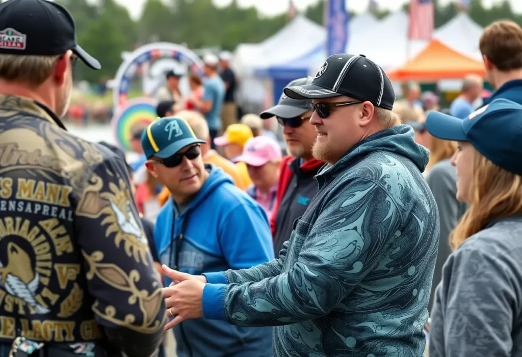
National Professional Fishing League Returns to Logan Martin Lake
Logan Martin Lake, September 22, 2025 News Summary The National Professional Fishing League (NPFL) is returning to Logan Martin Lake for its sixth stop of the season. Anglers will engage with...

Community Mourns the Passing of Charles Edward Myers
Pendleton, September 21, 2025 News Summary Charles Edward Myers, age 91, passed away peacefully at home, leaving behind a legacy of love and service in Pendleton. He is remembered for his...
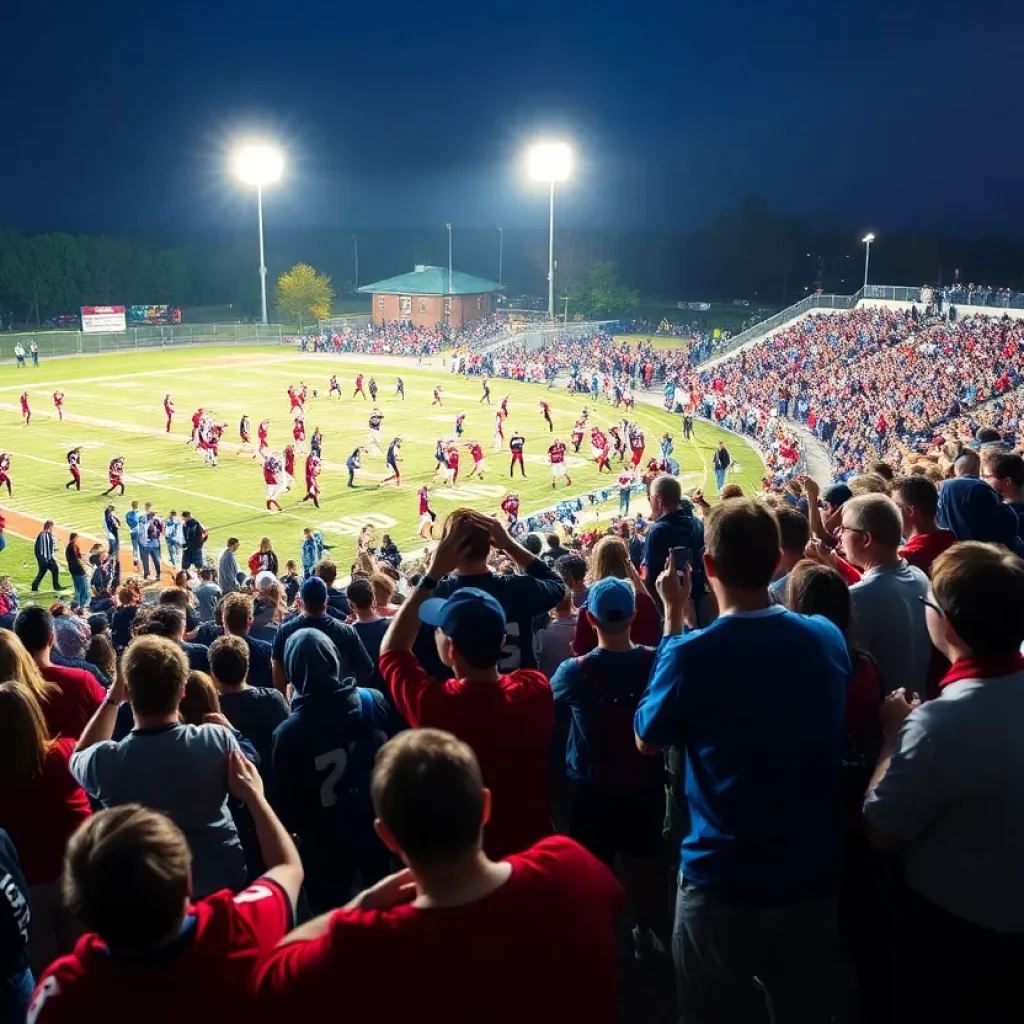
High School Football Action in South Carolina This Week
South Carolina, September 20, 2025 News Summary This week in South Carolina high school football, fans can look forward to 104 games, including 22 matchups featuring ranked teams. Among the standout...

Barbara Jean ‘BJ’ Glanton: A Legacy of Love in Greenwood
Greenwood, September 18, 2025 News Summary Barbara Jean ‘BJ’ Glanton, a beloved 88-year-old resident of Greenwood, South Carolina, passed away, leaving behind a lasting legacy of family and community love. She...

South Carolina High School Football Week 4 Preview
South Carolina, September 18, 2025 News Summary As high school football action heats up in South Carolina, fans are gearing up for an exciting lineup of Week 4 games. On September...
CRIME
Legal Dispute Over $200,000 Cargo Theft in Greenwood
Greenwood, September 19, 2025 News Summary Bay Island Sportswear, Inc. and Wildcat Retro Brands, LLC are embroiled in a legal battle concerning a theft claim of cargo valued at $200,000. The...
David Stumbo Announces Candidacy for Attorney General
Laurens, South Carolina, September 18, 2025 News Summary David Stumbo, the Eighth Circuit Solicitor, has declared his candidacy for South Carolina’s attorney general position. Stumbo aims to be tough on crime,...
Greenwood Man Sentenced to 45 Years for Murder
Greenwood, September 18, 2025 News Summary Ahmad Daterius Evans, a 23-year-old from Greenwood, has received a 45-year prison sentence for murder and attempted murder linked to a shooting incident. The tragic...
Concerns Rise Over Pedestrian Safety in South Carolina
Greenwood, South Carolina, September 17, 2025 News Summary Two recent fatal pedestrian accidents in South Carolina have sparked major concerns about pedestrian safety. A woman was struck by a pickup truck...
David Stumbo Launches Campaign for Attorney General
Greenwood, September 17, 2025 News Summary David Stumbo, a well-known prosecutor from Greenwood, has officially announced his candidacy for Attorney General of South Carolina. During the launch at Laurens County Museum,...
19-Year-Old Sentenced for Armed Robberies in Greenwood
Greenwood, S.C., September 17, 2025 News Summary Ty’rez Aunteavious Thomas, 19, was sentenced to 35 years in prison for a series of armed robberies in Greenwood, S.C. He lured victims via...

Pedestrian Struck and Killed on U.S. Highway 25
Greenwood County, September 16, 2025 News Summary A tragic accident occurred in Greenwood County when 44-year-old Aneeka Loraine Childs was struck by a Chevrolet Silverado while walking near Davis Street on...

Pedestrian Fatality in Greenwood: Investigation Underway
Greenwood, South Carolina, September 16, 2025 News Summary A tragic incident in Greenwood resulted in the death of 44-year-old Aneeka Loraine Childs after being struck by a pickup truck while walking...

Greenwood County Pedestrian Fatally Struck by Pickup Truck
Greenwood County, September 16, 2025 News Summary A tragic accident in Greenwood County resulted in the death of a 44-year-old pedestrian, Aneeka Loraine Childs. The collision occurred on Highway 25 Bypass...
POLITICS
David Stumbo Announces Candidacy for Attorney General
Laurens, South Carolina, September 18, 2025 News Summary David Stumbo, the Eighth Circuit Solicitor, has declared his candidacy for South Carolina’s attorney general position. Stumbo aims to be tough on crime,...
David Stumbo Launches Campaign for Attorney General
Greenwood, September 17, 2025 News Summary David Stumbo, a well-known prosecutor from Greenwood, has officially announced his candidacy for Attorney General of South Carolina. During the launch at Laurens County Museum,...

Elizabethton Community Honors the Legacy of Robert B. ‘Josh’ Allen
Elizabethton, Tennessee, September 16, 2025 News Summary The Elizabethton community is grieving the loss of Robert B. ‘Josh’ Allen, a cherished social worker, veteran, and church deacon. At 96, he left...
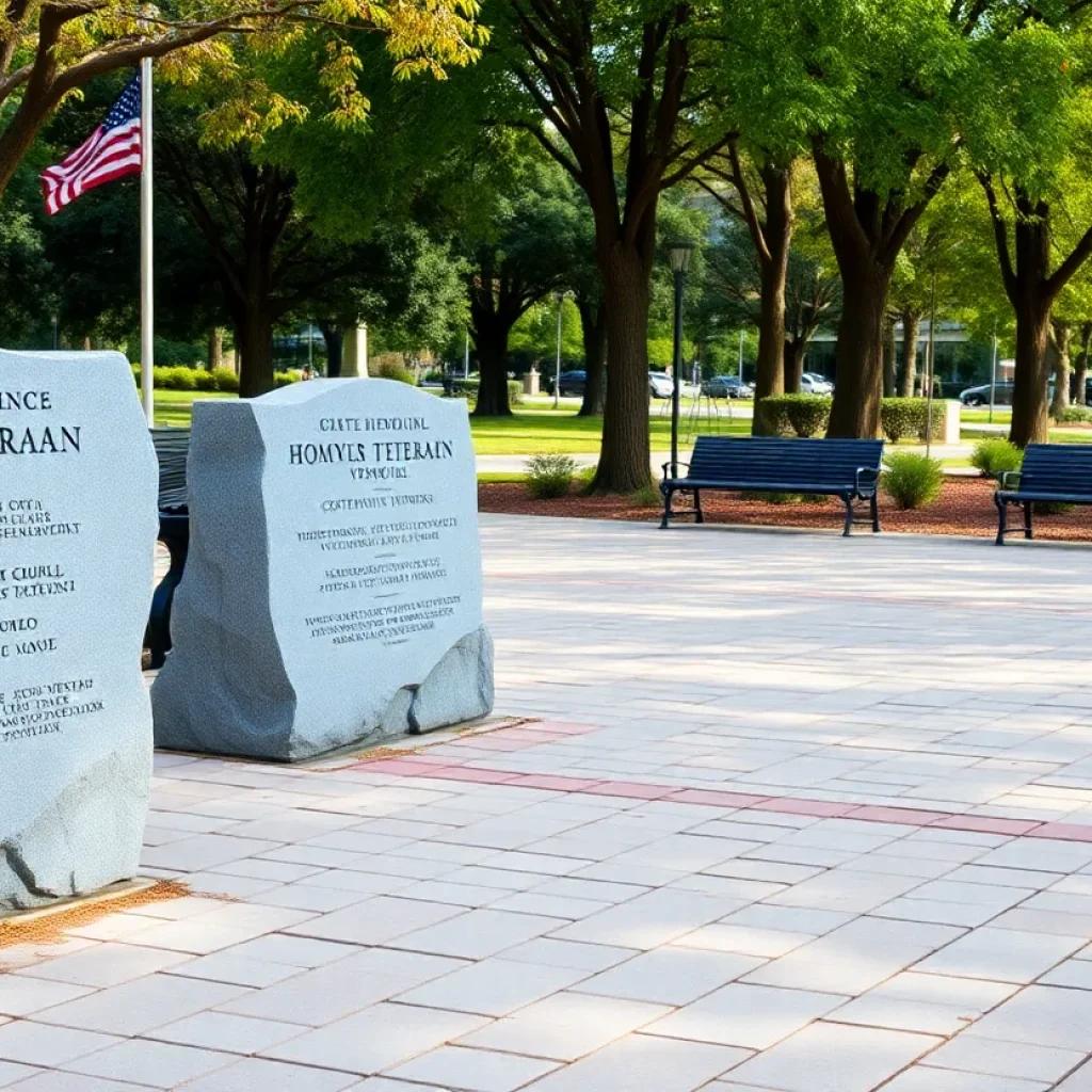
Alvin Johnson Honored for Service at Greenwood Veterans Plaza
Greenwood, September 15, 2025 News Summary Alvin Johnson, a 75-year-old Vietnam veteran and Purple Heart recipient, was honored at the Greenwood Veterans Memorial Plaza. With a career as a Major of...

Community Remembers Two Cherished Figures
Clinton, September 11, 2025 News Summary The community of Clinton mourns the loss of Bonnie Geraldine Layne Grubb Stone, 90, and Carol M. Greenwood, 88. Both made significant contributions to their...

Greenwood County Council Addresses Infrastructure Needs
Greenwood, SC, September 5, 2025 News Summary The Greenwood County Council convened to discuss urgent infrastructure improvements, focusing on road expansions, public safety enhancements, and maintenance strategies. Plans have been approved...

Earthquake Swarm Shakes Greenwood County, South Carolina
Greenwood County, September 4, 2025 News Summary Greenwood County, South Carolina, has reported a series of 17 earthquakes with the strongest measuring 3.0 since August 19. Experts attribute this unusual activity...

Rabies Confirmed in Wildlife in South Carolina Counties
South Carolina, September 3, 2025 News Summary The South Carolina Department of Public Health has confirmed two cases of rabies in wildlife, specifically a raccoon and a kitten, prompting health advisories...

Rabid Raccoon Triggers Health Alerts in Greenwood
Greenwood, South Carolina, September 3, 2025 News Summary A raccoon in Greenwood has tested positive for rabies, prompting health warnings for local pet owners. The South Carolina Department of Public Health...
SPORTS
T.L. Hanna Edges Out Greenwood in Thrilling Matchup
Anderson, SC, September 22, 2025 News Summary In a closely contested football game, T.L. Hanna emerged victorious over Greenwood with a score of 22-21. This win marks T.L. Hanna’s third straight...
Greenwood Christian Hawks Triumph Over Orangeburg Prep
Greenwood, SC, September 22, 2025 News Summary The Greenwood Christian Hawks celebrated a 34-21 victory against Orangeburg Prep, achieving their third consecutive win. Improving their season record to 5-1, the Hawks...
Greenwood Eagles Secure Fourth Consecutive Win
Greenwood, September 22, 2025 News Summary The Greenwood Eagles triumphed over the Batesburg-Leesville Panthers with a score of 2-0, marking their fourth consecutive victory. This win improves their season record to...
Greenwood Eagles Secure Third Straight Victory
Greenwood, SC, September 22, 2025 News Summary The Greenwood Eagles have achieved a third consecutive win, defeating the White Knoll Timberwolves 2-0. This victory improves their season record to 5-13. The...
National Professional Fishing League Returns to Logan Martin Lake
Logan Martin Lake, September 22, 2025 News Summary The National Professional Fishing League (NPFL) is returning to Logan Martin Lake for its sixth stop of the season. Anglers will engage with...
High School Football Action in South Carolina This Week
South Carolina, September 20, 2025 News Summary This week in South Carolina high school football, fans can look forward to 104 games, including 22 matchups featuring ranked teams. Among the standout...
South Carolina High School Football Week 4 Preview
South Carolina, September 18, 2025 News Summary As high school football action heats up in South Carolina, fans are gearing up for an exciting lineup of Week 4 games. On September...
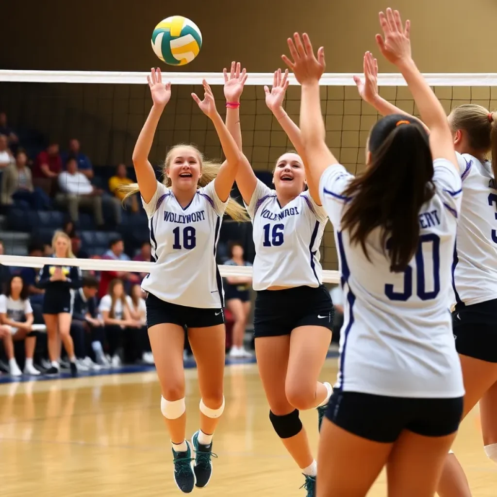
Woodmont High School Volleyball Team Secures Dominant Victory
Greenville, SC, September 18, 2025 News Summary Woodmont High School’s volleyball team celebrated a convincing 3-0 victory against the Greenwood Eagles, marking their seventh consecutive win over their rivals. The match...

Hough High Football Team Undefeated and Leading Rankings
Cornelius, North Carolina, September 18, 2025 News Summary Hough High School’s football team is currently undefeated with a 4-0 record, maintaining their top position in The Carolinas Top 25 poll. Their...