News Summary
Residents of York County and nearby areas are under a severe thunderstorm warning until 9:45 p.m. tonight. Strong winds and heavy rain are expected, with gusts up to 40 mph. Cities such as Gastonia, York, and Rock Hill are advised to seek shelter indoors. The storm could lead to hazardous conditions, including hydroplaning. Stay informed and prioritize safety during this extreme weather.
Severe Thunderstorm Warnings Hit York County and Nearby Areas
York County residents, it’s time to pay attention! The National Weather Service (NWS) has issued a severe thunderstorm warning that’s in effect until 9:45 p.m. this Tuesday. If you haven’t already noticed, a significant storm is rolling through the area with some potentially serious effects.
What’s Happening?
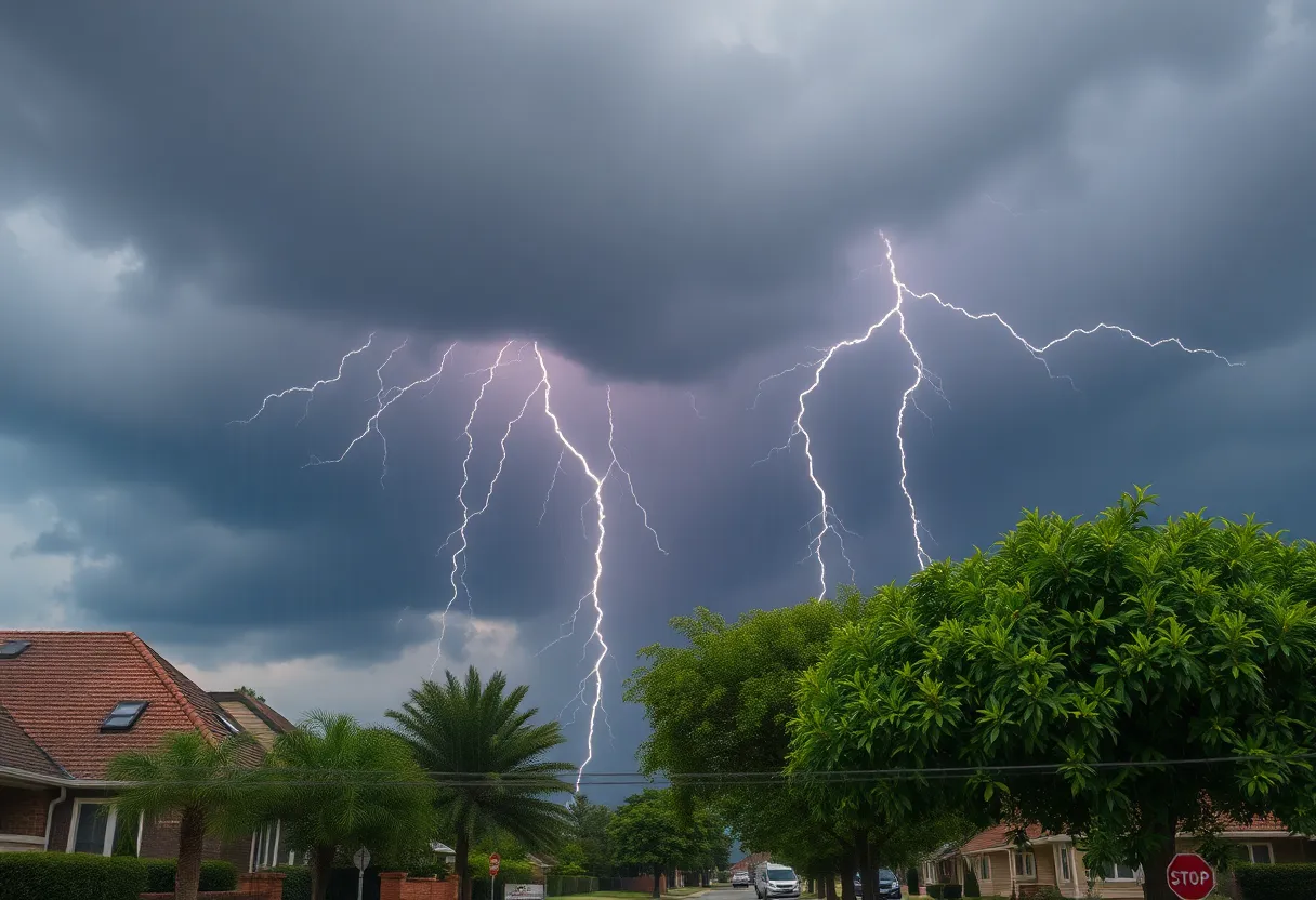
As of 9:07 p.m., Doppler radar has picked up a vigorous thunderstorm heading our way, moving northeast at a brisk 30 mph. The wind gusts in York County could hit up to 40 mph, which is strong enough to knock down tree limbs and send unsecured items flying. This storm isn’t just a light show; it’s packed with energy and danger!
Who’s Affected?
Several areas are feeling the brunt of this weather. If you’re in cities like Gastonia, York, Rock Hill, Fort Mill, Belmont, Tega Cay, Clover, Newport, or Cramerton, you should take cover! Residents of these cities are advised to seek shelter inside buildings to stay safe. It’s pivotal to note that lightning can strike as far as 10 miles away from the storm, so no outdoor adventures during this time!
Driving Precautions
Heavy downpours are expected, which could lead to water pooling on the roads. If you’re out driving, be sure to slow down and exercise caution. Remember, hydroplaning is a real risk when the roads are wet. It’s crucial to understand that hydroplaning is when your vehicle slides uncontrollably on a wet surface, leading to a loss of control. To stay safe, focus on driving at a moderate speed, ensure your tires are in good condition, and be mindful of the road conditions.
Earlier Updates
Earlier on Tuesday, at 8:11 p.m., the severe thunderstorm warning was updated for both Cherokee and York counties until 8:30 p.m.. Wind gusts were expected to reach up to 60 mph in that area. The storms were located along a line extending from Lincolnton to Gaffney, raising alarm about potential damage to trees and power lines as the storm continued to develop.
Stay Indoors!
Residents are being encouraged to move to an interior room on the lowest floor of any building to stay safe during the storm. Remember, with continuous cloud-to-ground lightning reported, the potential for strikes is nearing, increasing sharply as the storm encroaches. Thunder itself is a clear indicator that lightning could be heading your way.
More Weather Updates
It’s not just York County feeling the weather strain; flash flooding and damaging winds are also believed to be on the horizon for other regions like central New Jersey and the Tri-State Area. If you’re near New York’s south-facing beaches, be cautious of dangerous rip currents as thunderstorms loom. The storm activity is predicted to continue into the evening, but don’t lose hope just yet! Conditions are expected to shift, bringing some sunshine by the following day.
As this severe weather unfolds, keep your loved ones safe and be prepared. With the potential for storms still active in Lancaster and York counties, staying informed is more important than ever. So keep your cell phones charged, monitor the updates, and above all, stay safe!
Deeper Dive: News & Info About This Topic
HERE Resources
Mysterious Fireball Sighted Across Multiple States
Brilliant Fireball Lights Up Southeastern Skies
Bright Meteor Fireball Causes Sonic Boom in Georgia
Daytime Fireball Lights Up Southeastern Skies
Spectacular Fireball Lights Up Southeastern Skies
Controversial Plans for New Immigrant Detention Facility in Florida
Heat Advisory Issued for Upstate South Carolina and Georgia
Severe Storms and Tornadoes Cause Tragedy in North Dakota and Minnesota
Severe Weather and Heat Wave Impact U.S. Communities
Severe Thunderstorm Warning Issued for Upstate SC and WNC
Additional Resources
- The State
- Wikipedia: Thunderstorm
- PennLive
- Google Search: thunderstorm alerts
- York Dispatch
- Google Scholar: thunderstorm weather
- WGAL
- Encyclopedia Britannica: thunderstorm
- CBS News
- Google News: thunderstorm weather