News Summary
Greenwood County is under a severe thunderstorm warning until 10 a.m. with wind gusts reaching up to 40 mph and possible pea-sized hail. Residents are advised to seek shelter and stay informed, especially in nearby areas like Abbeville. Additionally, a tornado watch is in effect for surrounding counties. As the storm passes, it’s crucial to remain vigilant and prepared for changing weather conditions, including safety tips for driving on wet roads.
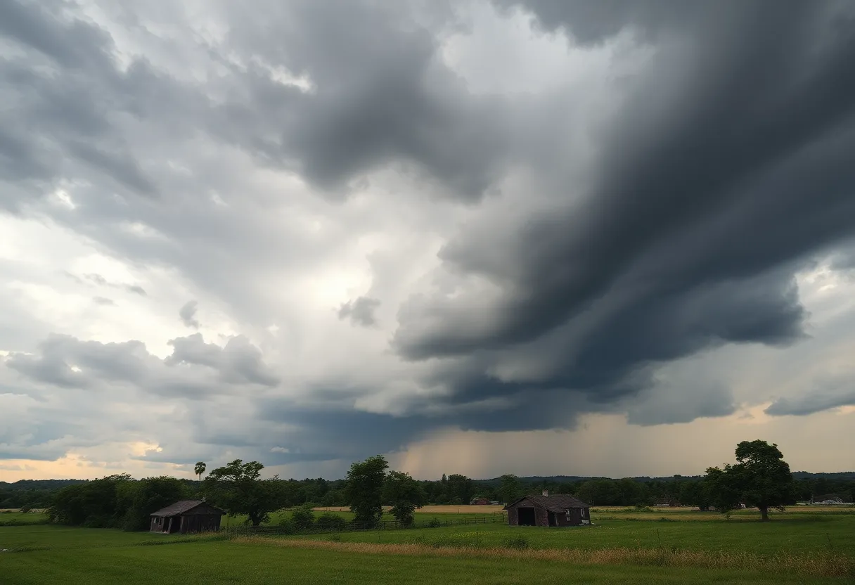
Severe Thunderstorm Warning Hits Greenwood County!
Guess what, folks? Greenwood County is under a severe thunderstorm warning until 10 a.m., and it’s time to grab your raincoats and hunker down! The storm causing all the fuss has already started to move out of the area, which means relief is on the way.
Here’s the scoop: An updated report from the National Weather Service, issued at 9:11 a.m., told us that the storm was still packing a punch in nearby Abbeville and Greenwood counties until 9:45 a.m. If you’re in those areas, stay alert! Wind gusts could reach an impressive 40 mph, and don’t be surprised if you see some pea-sized hail (about 0.25 inches), which could cause a little trouble.
Temperature Update
Let’s talk about the weather for the day! The forecast expects a 50% chance of rain, which means it could either end up being a wet day or a bit on the dry side. Temperatures are predicted to hit a high of 86°F and drop down to around 68°F in the night. So whether you’re planning to go out or stay in, it’s best to keep an umbrella handy!
Thunderstorm Safety 101
As we wait for the storm to pass, here’s something to keep in mind: if you’re outdoors, make sure to seek shelter inside a building. It’s the safest place to be during thunderstorms. The NWS suggests that when thunderstorms are on the horizon, the probability of lightning strikes increases significantly. Did you know that around 25 million lightning strikes happen in the U.S. each year? Yikes! While that’s a staggering number, these strikes can cause about 20 fatalities annually, so it’s crucial to stay informed and protected.
Hydroplaning Alert
And speaking of safety, let’s talk about hydroplaning. It occurs when a vehicle loses control while sliding on wet roads due to an excess buildup of water in front of the tires. The factors at play here include tire tread depth, your vehicle’s speed, and road conditions. It’s best to be extra cautious when driving today—if you sense hydroplaning may happen, remember not to panic! There are safety tips available to help you navigate those slippery roads.
Tornado Warning Update
But wait, there’s more! There’s also a tornado watch in effect for the surrounding Upstate counties, including Greenwood, Laurens, and Union, effective until 8 a.m. Friday. A tornado watch means conditions are favorable for tornado development, so keep a sharp lookout! On the other hand, a tornado warning indicates that a tornado has been detected. Being informed is key, folks.
Where’s the Storm Hitting?
If you live in places like Greenwood, Ninety Six, Troy, Bradley, Callison, Epworth, and even the beautiful Greenwood State Park, you are in the path of these storms. Be proactive and stay safe! The gusty winds may knock down some tree limbs or blow around anything not securely fastened.
In Summary
So there you have it, Greenwood! With thunderstorms and tornado watches brewing in the area and weather that can change on a dime, it’s better to stay alert and prepared. Remember, safety first, gather up your family, let them know what’s happening, and keep that ticker of info flowing. Thunderstorms may be on the way, but with a little preparation, we’ll ride them out together! Stay safe!
Deeper Dive: News & Info About This Topic
HERE Resources
Severe Thunderstorm Watch and Warnings Issued for Upstate South Carolina
Severe Thunderstorm Watch Hits South Carolina
Severe Thunderstorm Watch Issued for South Carolina
Greenwood Man Charged with Attempted Murder in Shooting Incident
Shooting Incident Shakes Greenwood Community
Shooting Incident Leaves One Man Seriously Injured in Greenwood
Severe Thunderstorm Warnings Issued for Greenwood County
Severe Thunderstorms Prompt Weather Alerts in Greenwood County
Severe Thunderstorms Disrupt Greenwood County
Severe Thunderstorm Watch Issued for South Carolina
Additional Resources
- Index Journal: Tornado Watch in Greenwood County
- Wikipedia: Tornado Warning
- Weather.com: Englewood CO
- Google Search: Severe Thunderstorm Warning
- Herald Online: Severe Weather Updates
- Encyclopedia Britannica: Thunderstorm
- Fox Carolina: Greenwood County Recovery Update
- Google News: Tornado Watch Greenwood