News Summary
A severe thunderstorm watch has been issued for Abbeville and Greenwood counties. The National Weather Service warns of risks including lightning and hydroplaning as wind gusts may reach 60 mph. Residents are advised to stay indoors and watch for potential flash flooding as the storm system approaches. With heavy rainfall and the threat of damaging winds, it’s essential to remain informed and safe. Relief is expected by Friday as clearer skies are forecasted.
Severe Thunderstorm Watch Hits Abbeville and Greenwood Counties
Residents of Abbeville and Greenwood counties, take heed! The National Weather Service (NWS) has just issued an updated severe thunderstorm watch that went into effect late Wednesday evening at 11:46 p.m. The watch will remain active until midnight on Thursday, keeping all eyes on the sky as the threat of serious weather looms.
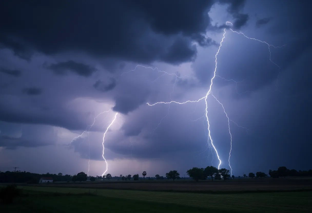
Lightning: A Growing Concern
When thunderstorms roll in, the risk of lightning becomes a significant concern. On average, the United States experiences around 25 million lightning strikes each year, especially prevalent during the warm summer months. While we often marvel at nature’s spectacular light show, the truth is sobering—there are about 20 lightning-related fatalities in the U.S. annually. The danger peaks as the storm draws near, hitting its most intense stride when the storm is directly overhead. As the storm moves away, the lightning threat diminishes, but not without leaving potential risks in its wake.
Stay Safe During Thunderstorms
Staying safe during a thunderstorm is paramount. The best advice is to remain indoors. But if getting inside isn’t an option for you, there are specific precautions to follow to ensure your personal safety. Although the specifics weren’t covered in detail, exercising caution is always a wise approach when dealing with unpredictable weather.
Watch Out for Hydroplaning!
Outside of lightning, there’s another major hazard to consider during thunderstorms—hydroplaning. This occurs when a vehicle loses traction on a wet road due to water accumulating in front of its tires. Essentially, the water pressure can lift your vehicle off the road’s surface, leading to a loss of control. Hydroplaning is often influenced by various road conditions; always drive carefully and be alert during wet weather to prevent slipping and sliding.
Fast-Moving Storms
Just before the latest watch was issued, an earlier severe thunderstorm warning was placed by the NWS at 8:12 p.m. the previous night, covering a wide array of counties including Elbert, Hart, Henderson, and many others. Wind gusts from the approaching storms could reach up to 60 mph, and they may also bring hail stones as large as 0.75 inches. With the severe weather advancing at speeds of approximately 50 mph, it’s essential to heed safety advice and move to interior rooms on the lowest floors to stay secure.
Potential for Damage
As the storm systems approach, the potential for damaging winds emerges, posing risks to trees and power lines across the region. Some specific areas that are anticipated to experience impacts include Greenville Downtown, Spartanburg, Shelby, Gaffney, and Laurens. With heavy rainfall already reported, many areas endured about 7 inches of rain, leading to flash flood alerts that were active until 4:45 a.m. the following Tuesday. This complex weather system’s ongoing presence means that residents should brace for continued rain over the coming days.
Looking Ahead
Hold tight, though! It looks like relief is on the horizon as clear weather is expected to break through this chaotic pattern, with forecasts hinting at clearer skies by Friday. Until then, stay updated, remain safe, and keep your umbrella handy as Abbeville and Greenwood counties weather through this stormy situation.
Deeper Dive: News & Info About This Topic
HERE Resources
Community Mourns the Loss of Tom Gordon
Severe Storms and Tornadoes Cause Tragedy in North Dakota and Minnesota
Severe Weather and Heat Wave Impact U.S. Communities
Major Heat Wave Set to Impact 255 Million Americans
Severe Thunderstorms Hit Upstate South Carolina
Severe Thunderstorms Cause Widespread Power Outages in Indianapolis
Severe Thunderstorm Watch Issued for Abbeville and Greenwood
Severe Thunderstorm Alert for Abbeville, Laurens, and Greenwood
Severe Thunderstorm Warning Issued for Upstate SC and WNC
Severe Storms Cause Devastation in Augusta Area
Additional Resources
- Myrtle Beach Online
- Wikipedia: Thunderstorm
- The State
- Google Search: Thunderstorm Safety
- Herald Online
- Google Scholar: Severe Thunderstorm
- Greenville Online
- Encyclopedia Britannica: Thunderstorm
- WYFF4
- Google News: Flooding South Carolina