News Summary
A severe thunderstorm watch has been issued for several counties in Upstate South Carolina, including Greenville, Greenwood, and Spartanburg. The alert warns of possible winds up to 60 mph and hail of 0.75 inches as storms approach, with significant impacts expected in various areas. Residents are advised to seek shelter and take precautions as the storm develops.
Severe Thunderstorm Watch and Warnings Issued for Upstate South Carolina
Greenville, SC – A severe thunderstorm watch has been issued by the National Weather Service (NWS) for several counties in Upstate South Carolina. The watch, which began at 7:17 p.m. on Saturday and is set to remain in effect until 11 p.m., covers Greenville, Greenwood, Laurens, Spartanburg, and Union counties. This development comes in response to forecasted conditions that pose a significant risk to residents.
At 7:42 p.m., the NWS elevated the alert to a severe thunderstorm warning for Anderson, Greenville, Laurens, Pickens, and Spartanburg counties. This warning indicated the possibility of winds reaching speeds of 60 mph and hail up to 0.75 inches in diameter. The storm was noted to be moving northeast at 45 mph, with the warning in effect until 8:30 p.m. EDT.
Potential Impact Areas
Areas anticipated to be affected by the severe weather include major locations such as Greenville Downtown, Easley, Pickens, Greenville Eastside, Greer, Mauldin, Taylors, Simpsonville, and Berea. An earlier update at 7:47 p.m. reported strong thunderstorms producing pea-sized hail and winds up to 50 mph in the Greater Pickens and Greenville County areas.
Doppler radar identified a strong thunderstorm located approximately 12 miles northwest of Greenville Downtown, tracking east at 25 mph. Other affected communities include Travelers Rest, Slater-Marietta, Tigerville, Lake Robinson, and Pleasant Ridge State Park.
Safety Precautions and Warnings
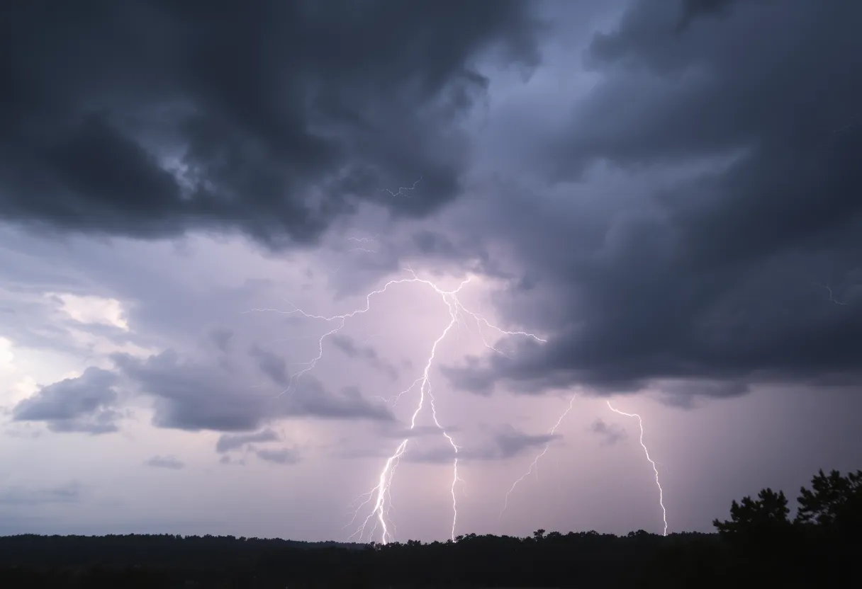
The NWS has emphasized the dangers associated with lightning, particularly during thunderstorms, which strike the United States roughly 25 million times a year, resulting in approximately 20 fatalities each year. The likelihood of lightning increases as storms approach and is at its peak when a storm is overhead. Residents are strongly advised to seek indoor shelter during such weather conditions.
Driving conditions may also be adversely affected, as hydroplaning can occur when a vehicle slides uncontrollably on wet roads. This happens when water accumulates in front of the tires faster than the vehicle’s weight can displace it. Drivers are advised to exercise caution and avoid travel unless absolutely necessary during severe weather conditions.
In the wake of the storm, the NWS has alerted residents to the possibility of damaging winds affecting trees and power lines, advising them to report any significant weather-related incidents to the relevant authorities. In a further update at 9:23 p.m. on Friday, severe thunderstorms were once again reported in Greenville and Spartanburg counties, with wind gusts reaching 40 mph and marble-sized hail observed.
Lightning Safety Reminder
The seasonal peaks of thunderstorms typically see an uptick in lightning strikes, which underscores the importance of taking safety precautions. Residents are encouraged to follow guidance from the NWS and local officials and remain vigilant as this severe weather system unfolds.
As severe thunderstorms are expected to continue impacting the region, staying indoors and maintaining an awareness of weather updates is crucial for the safety of all individuals in the affected areas.
Deeper Dive: News & Info About This Topic
HERE Resources
Severe Thunderstorm Watch Hits South Carolina
Severe Thunderstorm Watch Issued for South Carolina
South Carolina Battles Widespread Wildfires Amid Emergency
South Carolina Faces Disappointing First Snowfall of 2024
Severe Thunderstorm Warnings Issued for Greenwood County
South Carolina Faces Hurricane Preparedness Challenges
Severe Thunderstorms Prompt Weather Alerts in Greenwood County
Wildfires Rage in South Carolina, Prompting Emergency Measures
Greenville Approves Bridge Replacement Amid Weather Alerts
Wildfires Lead to Emergency Measures in South Carolina
Additional Resources
- Greenville Online
- Island Packet
- The State
- Fox Carolina
- WYFF4
- Wikipedia: Severe Thunderstorm
- Google Search: Severe Thunderstorm South Carolina
- Google Scholar: Severe Thunderstorm
- Encyclopedia Britannica: Thunderstorm
- Google News: Greenville Weather